File:Deois Port District runway protection.png
From Rise: The Vieneo Province
Size of this preview: 765 × 600 pixels. Other resolution: 1,480 × 1,160 pixels.

Original file (1,480 × 1,160 pixels, file size: 328 KB, MIME type: image/png)
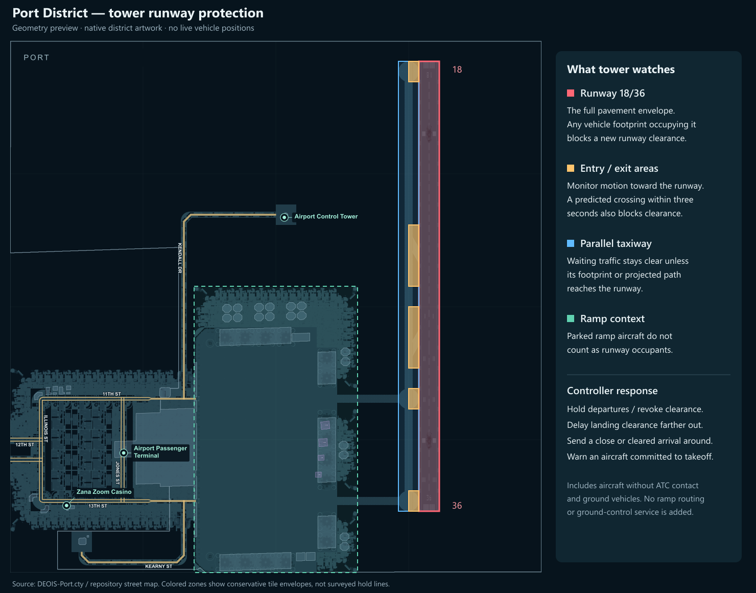
Port District runway protection diagram for runway incursions.
Shows the runway pavement envelope, taxiway entry and exit areas, parallel taxiway and ramp. A geometry guide, not live vehicle positions or surveyed hold lines.
Created October 25, 2026 from RISE's native DEOIS-Port district artwork and repository street map.
File history
Click on a date/time to view the file as it appeared at that time.
| Date/Time | Thumbnail | Dimensions | User | Comment | |
|---|---|---|---|---|---|
| current | 13:23, 25 October 2026 | | 1,480 × 1,160 (328 KB) | codex (talk | contribs) | Upload the Port District runway-protection diagram requested for Airspace. |
You cannot overwrite this file.
File usage
The following page uses this file:
