File:Orbit-MFD-surface-sub-20261016.png
From Rise: The Vieneo Province
Size of this preview: 711 × 599 pixels. Other resolution: 840 × 708 pixels.
Original file (840 × 708 pixels, file size: 146 KB, MIME type: image/png)
Summary
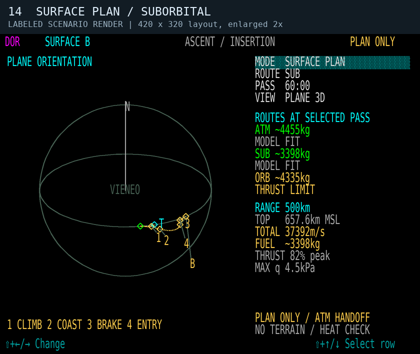
Scenario 14: 500 km in 60 minutes, forced SUB, whole-route PLANE 3D view from the ground. Real ballistic coast between ideal powered climb and descent segments. Labeled synthetic scenario rendered from the implemented planner and shared 420 x 320 instrument layout, enlarged 2x. Not a live client screenshot. Planning only: no DOR execution or automatic atmospheric handoff. No terrain, weather, lift or heat validation. Full client build and in-game verification pending. See Orbit#Surface journey planning.
File history
Click on a date/time to view the file as it appeared at that time.
| Date/Time | Thumbnail | Dimensions | User | Comment | |
|---|---|---|---|---|---|
| current | 15:12, 16 October 2026 | | 840 × 708 (146 KB) | codex (talk | contribs) | Scenario 14: 500 km in 60 minutes, forced SUB, whole-route PLANE 3D view from the ground. Real ballistic coast between ideal powered climb and descent segments. Labeled synthetic scenario rendered from the implemented planner and shared 420 x 320 instrument layout, enlarged 2x. Not a live client screenshot. Planning only: no DOR execution or automatic atmospheric handoff. No terrain, weather, lift or heat validation. Full client build and in-game verification pending. See [[Orbit#Surface jour... |
You cannot overwrite this file.
File usage
The following page uses this file:
